Cadastral plan over an orthophoto: how to check the actual land boundaries
When assessing a plot, knowing the area in the listing is not enough. You need to understand where the plot appears to lie on the ground, how the cadastral boundary aligns with the aerial image and which questions are worth asking before buying land.
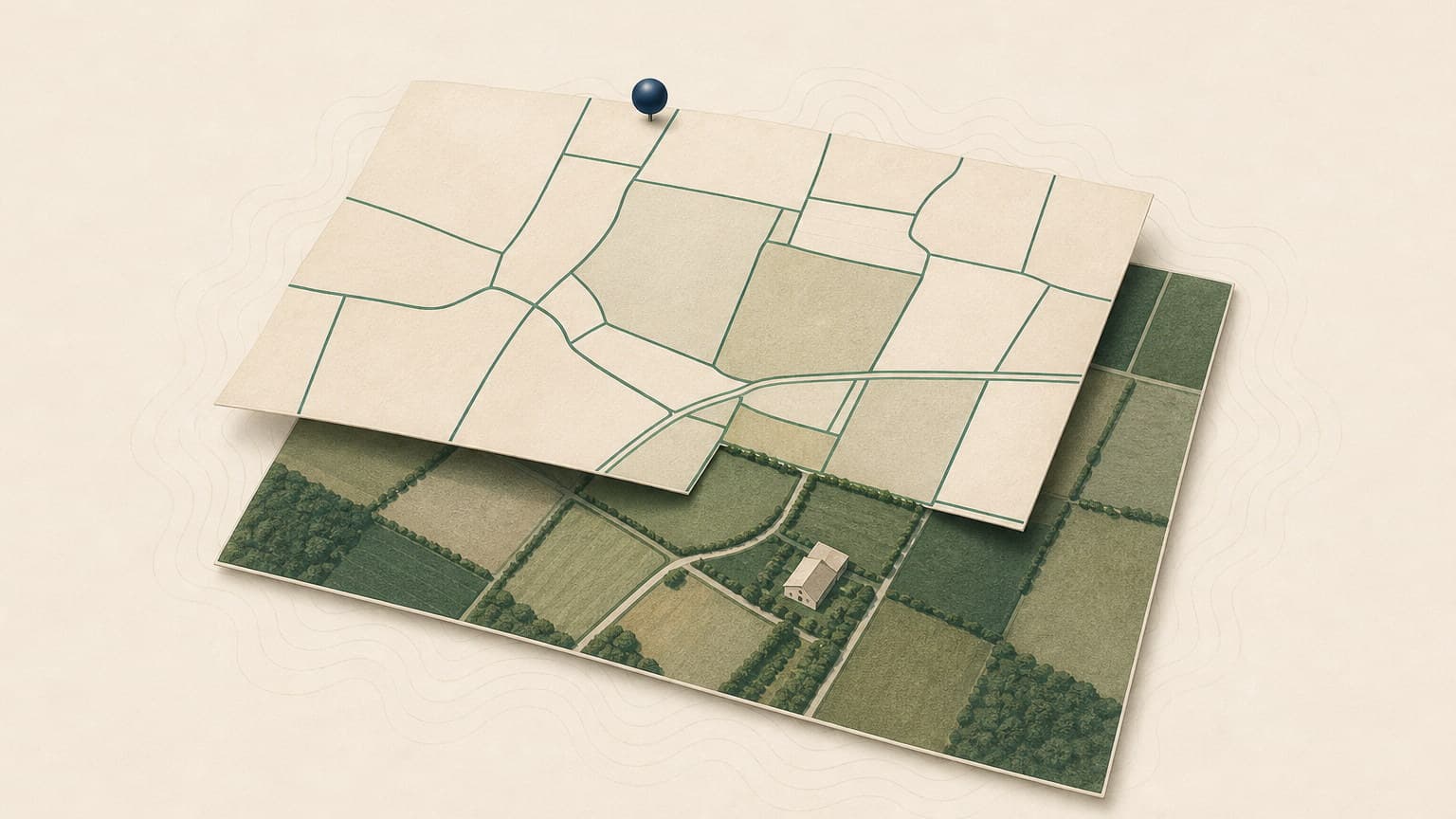
A cadastral plan over an orthophoto overlays the cadastral boundary on an aerial image, allowing you to compare the documents with the visible occupation of the land.
An orthophoto helps with orientation and identifying indicators, but does not establish legal boundaries on its own or replace a cadastral surveyor's measurements.
Differences between the fence, road, buildings, visible use and cadastral boundary should be treated as questions to clarify before buying land.
Verifi Standard helps with the land register extract, grid, risks and environment; Verifi Complet adds the cadastral plan over an orthophoto for land where visible boundaries matter.
What to check on an orthophoto
Overlaying cadastral data on the aerial image helps reveal differences between the documents and conditions on the ground.
Verifi helps you prepare the right questions and identify important warning signs. For complex legal situations, clarify the decision to sign with your notary or lawyer.
The orthophoto shows the difference between the line in the documents and the land in use
Overlaying cadastral data on the aerial image helps you spot fences, roads, buildings and surroundings more quickly.
An orthophoto does not replace a topographical survey, but is excellent for initial screening.
What a cadastral plan over an orthophoto is
In practical terms, a cadastral plan over an orthophoto is an overlay of the plot's cadastral data on a geometrically corrected aerial image. The cadastral boundary shows how the property is identified in the records, while the orthophoto helps you see what is visible on the ground: roads, fences, buildings, crops, yards, surroundings or differences in use.
For the buyer, the value lies not just in the image, but in the comparison: the area in the land register, the plot's shape, land boundaries, access visible in the image and the reality you check on site. An online cadastral plan can be a good starting point, but must not be read as a final technical or legal verdict.
Why the orthophoto matters before buying land
Before buying land, many details seem straightforward in discussions with the seller: it has a road, the fence is on the boundary, the neighbour knows, the land is clear. The orthophoto does not automatically confirm these claims, but helps you see where more precise questions are needed.
For example, a plot may have a clear cadastral boundary, but the road in use may appear to lie outside it or on someone else's land. A fence may be set back from the boundary or cross the cadastral line. A building, hardstanding, ditch or area of vegetation may suggest a use different from that described in the listing.
These observations do not automatically mean there is a problem. They mean it is worth clarifying matters through documents, measurements, discussions with specialists and a physical inspection of the land.
What you can realistically see on an orthophoto
A good orthophoto helps you read the land in context. It is not the same as a location and boundary plan prepared for cadastral procedures, but it can make differences between the paperwork and the image clearer.
- Plot shape: see whether the plot is regular, narrow, wedge-shaped, fragmented or difficult to use.
- Apparent access: see whether there is a visible road, whether access appears to be constructed or whether the plot seems isolated.
- Fences and visible boundaries: compare the cadastral boundary with existing fencing where visible.
- Buildings and occupation: observe buildings, outbuildings, hardstanding, internal roads or uses not mentioned in the seller's description.
- Surroundings: see proximity to watercourses, industrial buildings, railway lines, busy roads or industrial areas.
Verifi Complet combines the land register extract with the orthophoto, making visible boundaries and available data easier to interpret.
Land boundaries: what to compare between the land register, cadastre and image
Checking land boundaries starts with official data: the cadastral number, land register, area and any encumbrances or easements. A cadastral plan over an orthophoto adds a visual reading of this data, but does not rewrite it.
A useful comparison asks three questions:
- Does the cadastral boundary appear to include what is being sold? If the fence, yard in use or area shown by the seller does not reasonably align with the boundary, ask for explanations.
- Is access documented or merely used? A road visible on the orthophoto may be a public road, an easement, private property or simply a track. The documents matter.
- Is there occupation across the boundary? Buildings, fences or improvements near the edge of the plot may require a cadastral surveyor's check, especially when buying for construction.
Risk indicators you should not ignore
Some indicators become apparent quickly when you place the cadastral plan alongside the orthophoto. They do not prove a dispute or error on their own, but may prevent an overly hasty purchase.
Checklist before buying land
An online cadastral plan is useful, but a sound decision comes from bringing checks together. Before signing the promise or paying an advance, request specific documents and clarification.
- A current land register extract to see the owner, area, encumbrances, easements and any notices.
- Relevant cadastral documentation, especially where there are doubts about the shape, neighbouring plots, road or land boundaries.
- Confirmation of access: public road, registered easement, co-ownership or another verifiable legal arrangement.
- An on-site check, ideally with clear reference points and photographs, to compare the image with current reality.
- Context checks: flooding, environment, surroundings, pre-emption, planning and the seller's history, as applicable.
An orthophoto is not enough to establish whether land can be built on. You also need planning rules, an urban planning certificate for your purpose and, where the stakes are high, confirmation from an architect, notary, lawyer or cadastral surveyor.
How Verifi helps
Verifi does not promise to establish legal boundaries or replace cadastral measurements. Its role is to bring important data into an easy-to-read report, so you can see where genuine questions remain before proceeding.
Verifi Standard is the appropriate route for a land register extract, notarial valuation grid, main risks and environment: owner, identifiers, encumbrances, mortgages, prohibitions and area context.
Verifi Complet is better suited to land where risks go beyond cadastral records: orthophoto, access, surroundings, agricultural pre-emption, planning and the seller's background. It does not turn risky land into safe land, but helps you know what to ask before committing.
Frequently asked questions
Is an orthophoto proof of a property boundary?
No. An orthophoto is useful for orientation and visual interpretation, but the legal boundary is checked through cadastral records, documents, measurements and authorised specialists. See also how to find a plot's area without a cadastral number.
Can I buy land based only on an online cadastral plan?
That is not prudent. An online cadastral plan may show important indicators, but the purchase must be supported by a current land register extract, documents, notarial checks and, where doubts exist, a cadastral check.
If the fence does not align with the cadastral boundary, is that a problem?
It may be a simple difference in representation, a misplaced fence or an actual dispute. Treat it as an issue to clarify, not an automatic verdict.
Which should I choose for land: Verifi Standard or Complet?
Choose Standard if the priority is a land register extract plus the grid, main risks and environment. Choose Complet for an orthophoto, pre-emption, infrastructure and additional seller-related checks as well.
Check the land with the land register, orthophoto and risk context.
For an initial check, Verifi Standard is suitable when you need the land register extract, grid, risks and environment. For land where visible boundaries, access, surroundings, third-party rights or the seller's background matter, Verifi Complet also includes the orthophoto.